


Blog
- Details
- Written by Andrew Revill
- Category: Blog
- Published: 16 June 2015

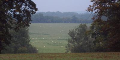
To support the development and evaluation of the GREENHOUSE spatial and temporal upscaling framework, within-field (metres) measurements are carried out to determine the diurnal and seasonal trends in CO2, CH4 and N2O emissions over dominant UK land-covers. For each of the GREENHOUSE measurement campaigns, a comprehensive knowledge of the spatial variability in site characteristics (e.g. soil moisture and solar radiation) that may affect trace gas exchanges is key to deciding the best possible locations for deploying monitoring instruments. These instruments chiefly include the York Skyline automated chamber system and eddy covariance flux towers.
- Details
- Written by Mathias Disney
- Category: Blog
- Published: 30 April 2015

As part of the GREENHOUSE activities in 2015, the NERC Airborne Research and Survey Facility (ARSF) will be collecting high resolution optical and LIDAR remote sensing data over the various GREENHOUSE field sites in Lincolnshire, Dumfries and Harwood Forest, and the surrounding areas.
- Details
- Written by Joseph Pitt
- Category: Blog
- Published: 11 April 2015
You wouldn't imagine that any of the great revolutions in science came about whilst sitting in a van at Corley service station, and this visit proved no exception. It will probably not feature in any GAUGE campaign highlights package. Nevertheless, as we drove on towards Cranfield I could sense the initial sparks of enthusiasm for this summer's approaching campaign flicker ever closer to striking. We were heading for the Facility for Airborne Atmospheric Measurements, known to most as FAAM, bringing instrumentation in the form of Manchester University's QCLAS (Quantum Cascade Laser Absorption Spectrometer) and CIMS (Chemical Ionisation Mass Spectrometer), ahead of the GAUGE re-fit of the large Atmospheric Research Aircraft.
Read more: The view from above: greenhouse gas measurement on the FAAM Research Aircraft
- Details
- Written by Matthew Couldrey
- Category: Blog
- Published: 18 March 2015
One facet of the RAGNARoCC project involves using computer simulations of the Earth climate system to develop our understanding of an incompletely observed system. These numerical models help us to learn about how systems such as the oceans and atmosphere might evolve in the future as a result of increasing carbon emissions. Beyond this, they can also teach us how the parts of these systems that are difficult to observe are working. Take, for example, the ocean carbon system. We know that human activities have increased the atmospheric concentrations of carbon dioxide since the onset of the industrial era, and that about a quarter of these emissions are taken up by the global ocean. But how does this rather important ‘ocean sink’ of CO2 work?
Read more: How does anthropogenic carbon dioxide enter the ocean?
- Details
- Written by Andrew Revill, Emanuel Blei
- Category: Blog
- Published: 31 July 2014
As part of the GREENHOUSE project, a one month long field campaign was conducted to gather information on spatial and temporal patterns of greenhouse gas fluxes from arable farmed land. This campaign was carried out on a rapeseed crop site, located in Lincolnshire, from March to the beginning of May 2014. The principal participants were the Centre of Ecology and Hydrology (Wallingford, Edinburgh and Lancaster), the University of York and the University of Edinburgh.
Read more: Field campaign: greenhouse gas fluxes in a rapeseed crop site
- Home

- Blog